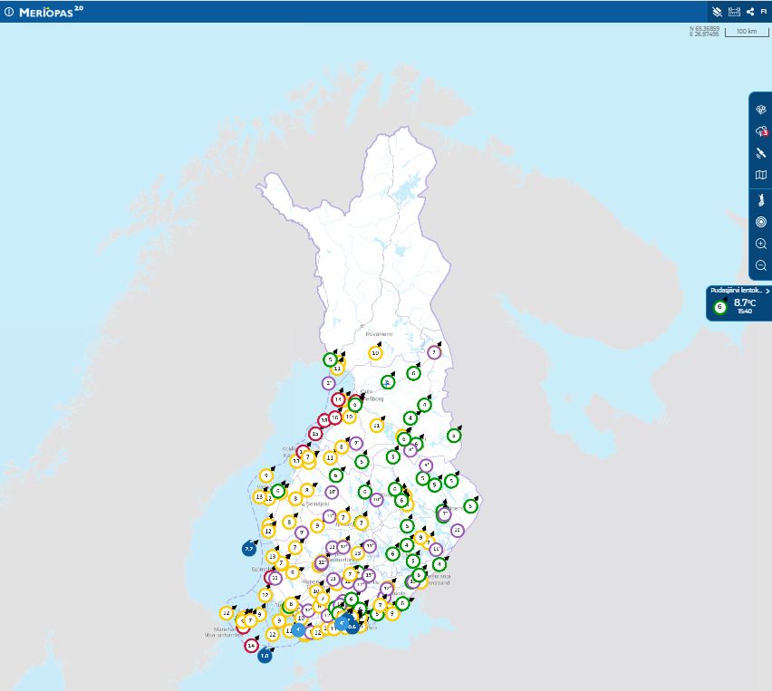
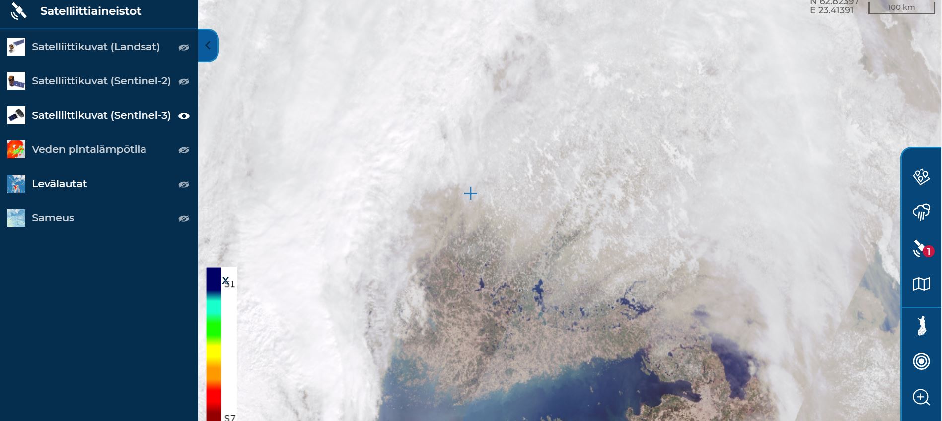
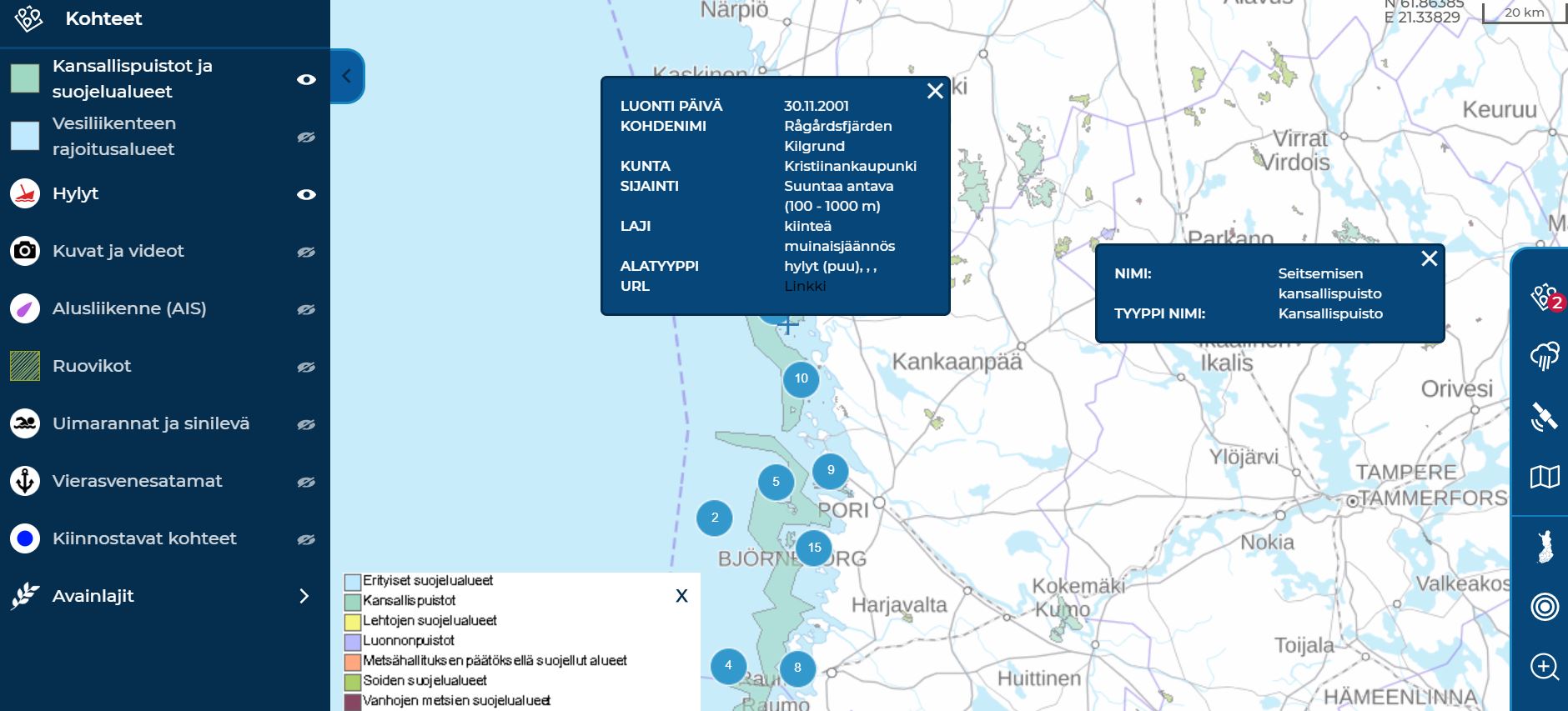
Meriopas.fi offers information about sea areas, the maritime ecosystem and also other environmental information and visualises it on a map. For example, you can find out
- wind speed,
- air and water temperatures,
- vessel traffic,
- algae situation,
- wrecks,
- places of interest and much else!
Meriopas.fi uses open data from Finnish Environmental Institure, Finnish Meteorological Institute and Finnish Transport Infrastructure Agency. The service is available also in English.
The service is part of the itämeri.fi site, which is produced to assist availability of Finnish marine data and information, and has been developed in cooperation with: Finnish Environment Institute (SYKE), Finnish Meteorological Institute (FMI), Natural Resources Institute Finland (LUKE), Metsähallitus, Geological Survey of Finland (GTK), Finnish Transport agency, Finnish Heritage Agency, Brahea Centre at the University of Turku, Regional Council of Southwest Finland and Ålands landskapsregering. The project has been funded by the European Maritime and Fisheries Fund (EMFF).