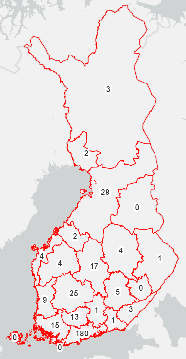
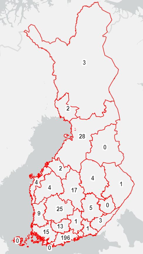
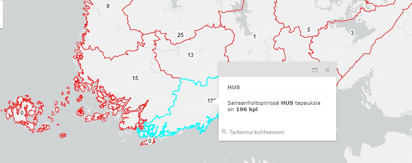
Coronavirus is spreading fast in Europe and in Finland. This showcase visualises the number of infections in Finland and shows them on a map. Coronavirus map works well on mobile as well.
Showcase uses open data from Helsingin Sanomat. The data is updated automatically every two minutes.
Note that the map does not give an accurate view of the Coronavirus situation in Finland because since 14.3. health authorities are no longer testing all patients presenting with symptoms in Finland. Thus the actual number of infections is bigger.
Read about the latest updates on Coronavirus in Finland from the Finnish institute for Health and Welfare's website.